Service Spotlight: Geospatial Capabilities
The Thrasher Group is always looking for new ways to serve our clients and how to stay on the cutting-edge of industry technology. Our geospatial team is an important part of that effort. With the highest quality drones on the market, millions of acres of aerial imagery in hand, and in-depth data capture capabilities, Thrasher offers unparalleled options for your project needs.
Want to learn more? Take a look below for five ways Thrasher has been using this expertise:
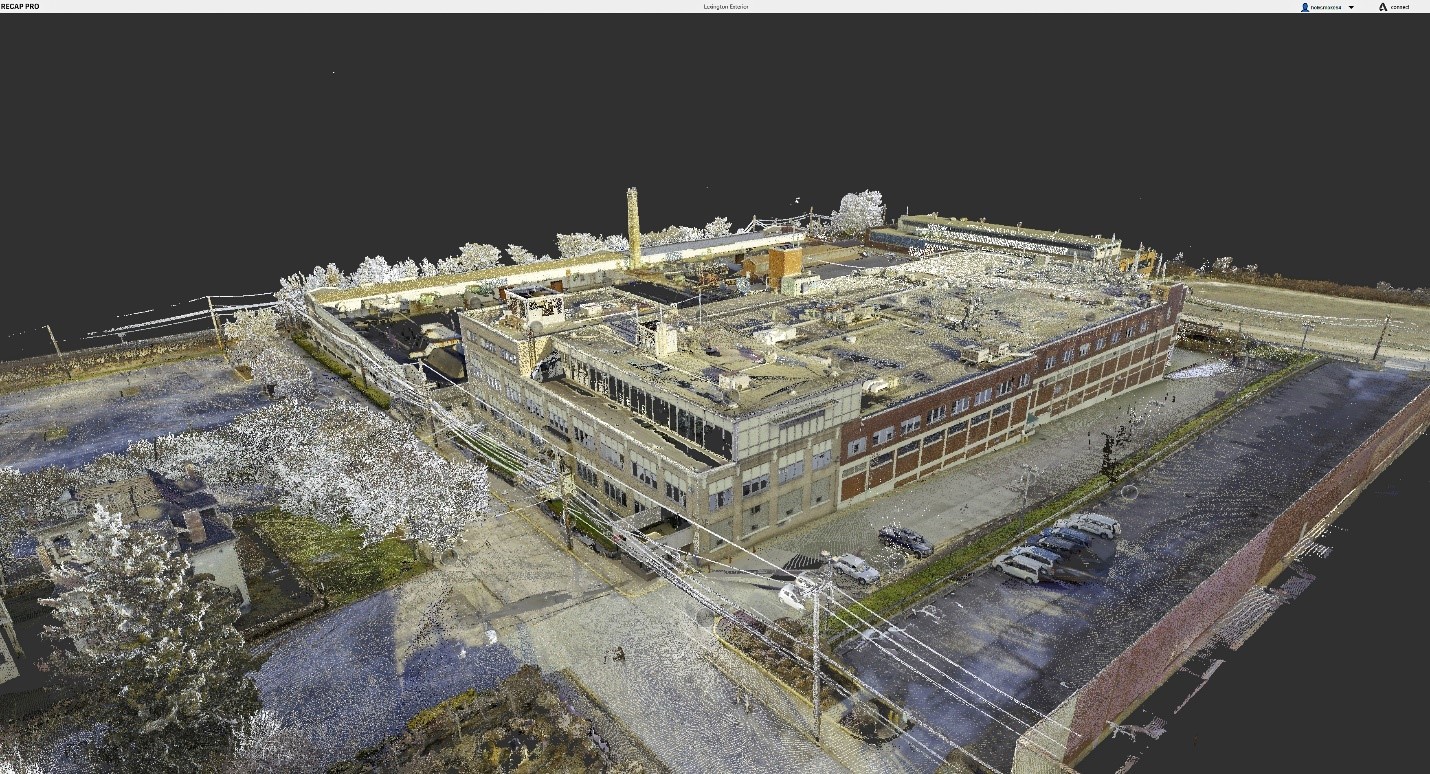
Warehouse Laser Scanning
When you have massive amounts of data to process, Thrasher’s got it. Our team partnered with another local company to conduct a terrestrial laser scan of a 400,000-square foot warehouse building. The purpose of the project was to provide the client with an accurate as-built of the building for future remediations and upgrades. Thrasher used our Leica RTC 360 Laser Scanner to quickly, accurately, and safely survey the building. The Laser Scanner is the perfect tool for complex problems with its ability to capture 2 million points per second at around 2 minutes each scan. It’s a quick and efficient way to gather all of the data you need.
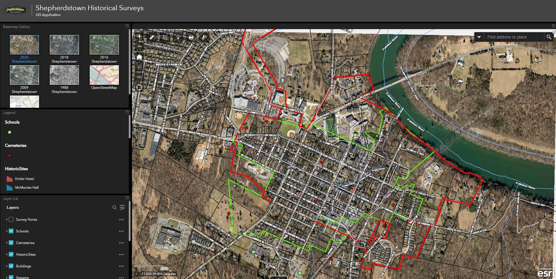
Corporation of Shepherdstown Historic Data GIS Mapping
When you need to track information across a large area, Thrasher’s got it. The firm was selected to create a Historic Data Geodatabase and Web Application for the Corporation of Shepherdstown. Working with their Planning Office, Thrasher mapped out the historical surveys of the area and provided a geodatabase and GIS Web Application via ArcGIS Online. The team also acquired springtime aerial photography of the area for the basemap. The dataset included historic flights of the area, a parcel layer, zoning districts, streets, hydrology, and other basic mapping features. The goal of the project was to provide Shepherdstown with an easy-to-use application to assist them in preserving the historic district and planning for the future.
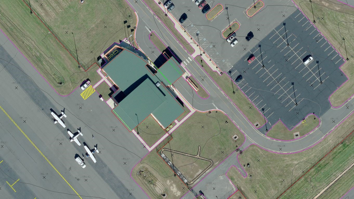
Stafford Airport Aerial Mapping with UAS LiDAR
When you’re looking for highly accurate mapping, Thrasher’s got it. Thrasher’s Unmanned Aerial Systems (UAS) and Aerial Mapping Teams were contracted by the Stafford Airport to complete Contour and Planimetric Data needed for future engineering work. The project created unique challenges for the UAS team because of the high level of activity at the Airport. Thrasher’s experts worked closely with Tower Control to ensure a safe and efficient process. This partnership allowed us to acquire high resolution LiDAR using the Reigl VUX-1 Long Range LiDAR Sensor and produce high-accuracy mapping data.
2020 Spring Flight
When you want a clear view of your project area, Thrasher’s got it. Our team takes great pride in our yearly spring flights. Thrasher’s Aerial Mapping team flies a large regional area annually to collect high-quality, leaf-off imagery that is designed to produce engineering grade, two-foot contours. In 2020, we flew seven million acres of coverage! This enables us to provide on-demand, cost-effective imagery upon request – once the leaves arrive in the spring, you can’t beat having this clear-cut imagery in the bank.
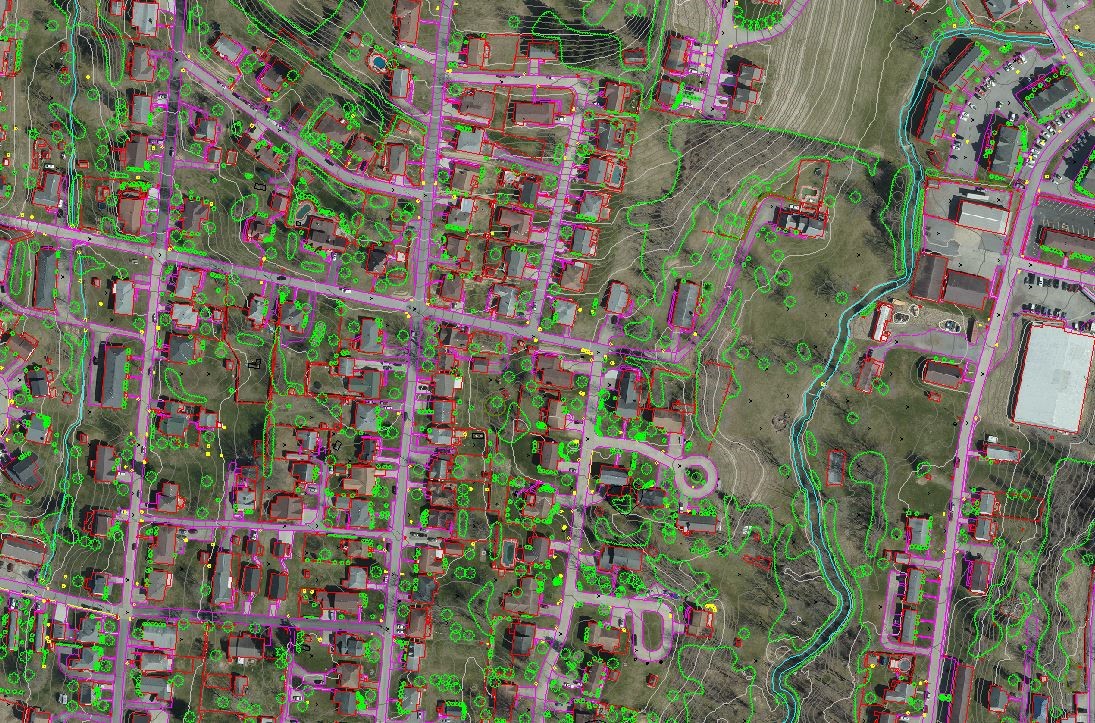
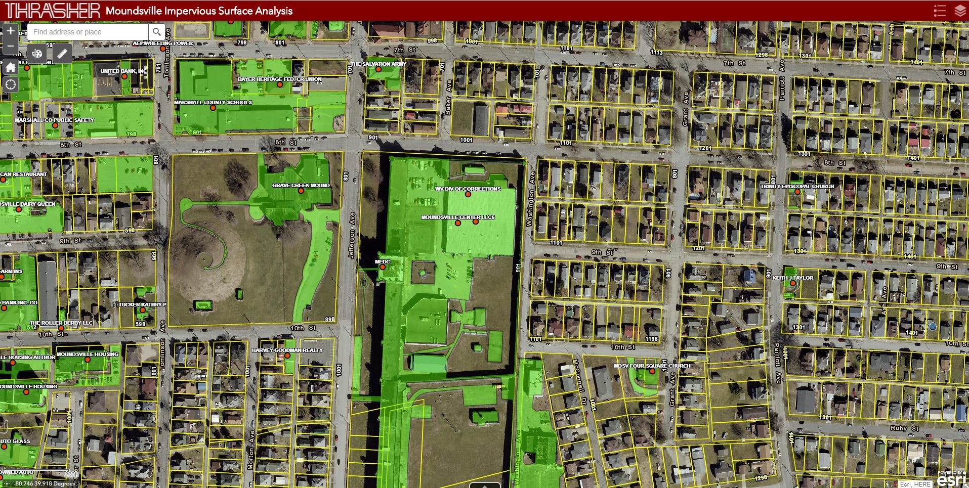
City of Moundsville Impervious Surface Mapping
When you have a complex problem, Thrasher’s got it. The City of Moundsville Utility Board needed data on impervious surface square footages for their customers. Thrasher’s GIS and Aerial Mapping teams took on the task! We used our most recent springtime aerial imagery of the area and ArcGIS Tools to analyze and classify impervious surfaces from the imagery’s fourth band. With the leaf-off imagery as a base, Thrasher was able to run image analysis to efficiently classify the areas into pervious and impervious surfaces. Then, the polygons were split based on parcel data and square footages were applied to the parcel area.

